
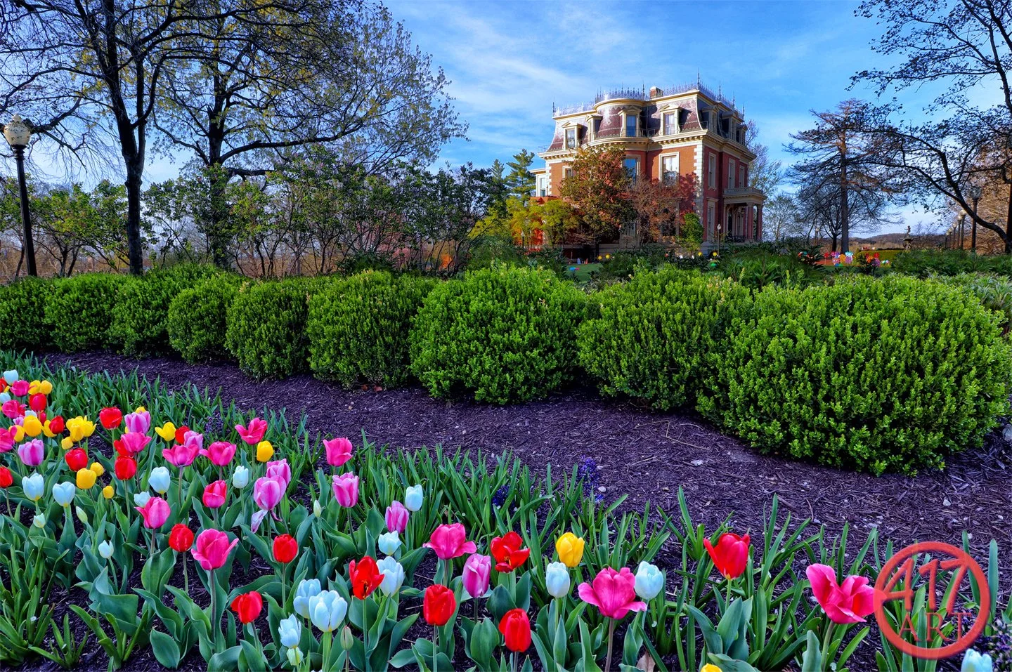
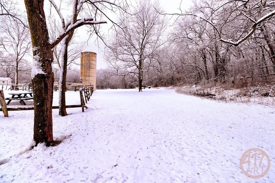
#165 - Jefferson City

#164 - Jefferson City

#163 - Jefferson City
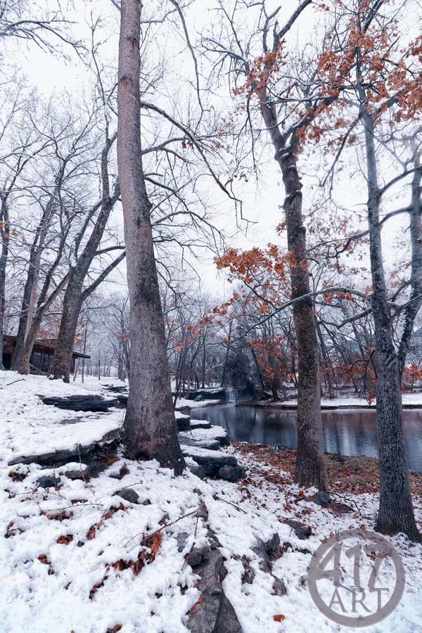
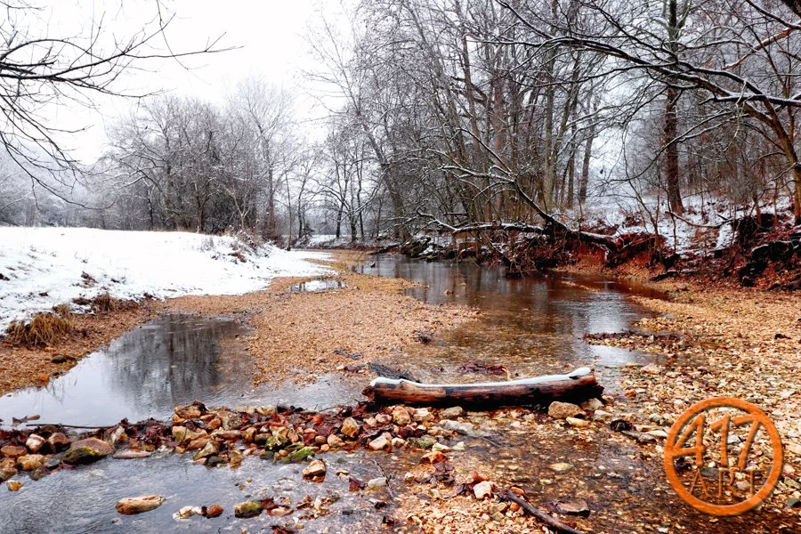
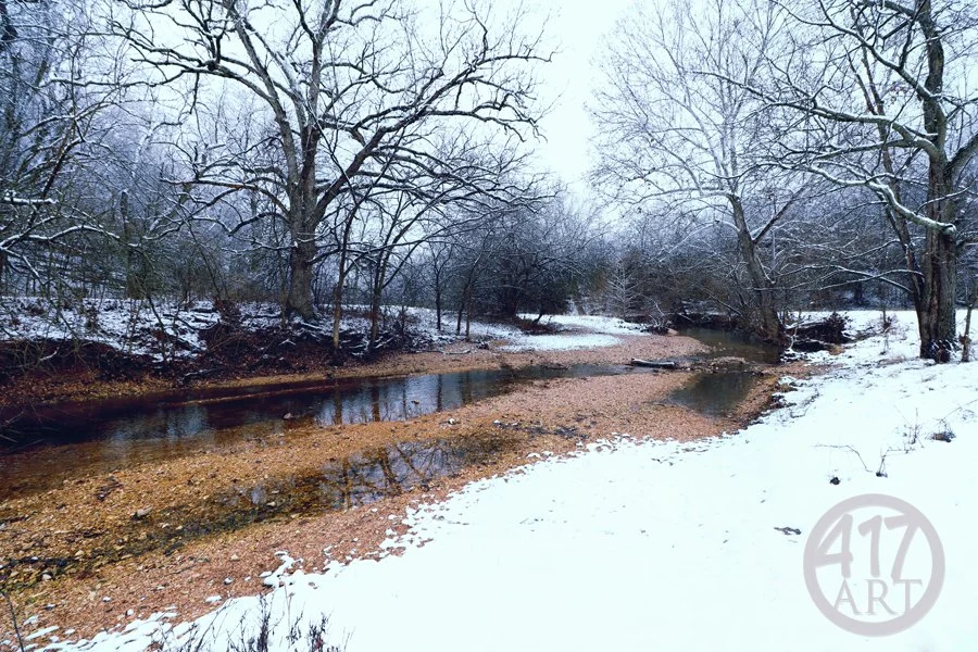
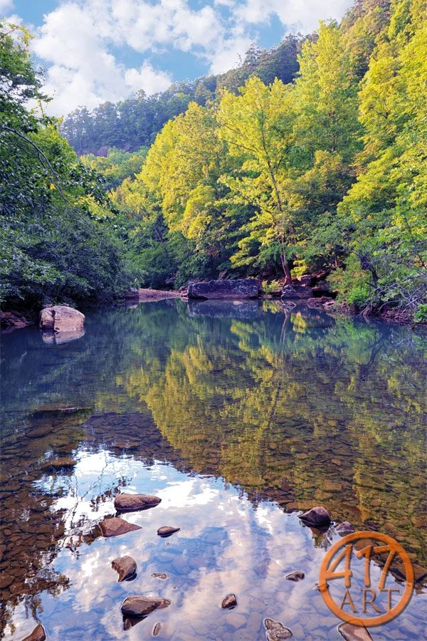
#162 - Jones Branch
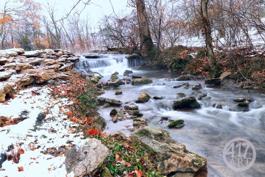
#161 - Jones Branch
#160 - Jones Branch
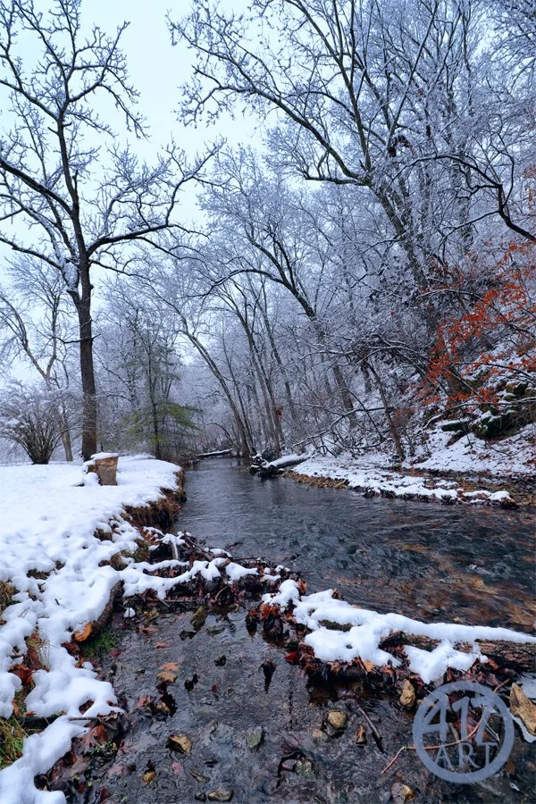
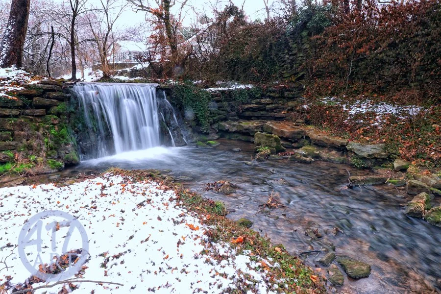
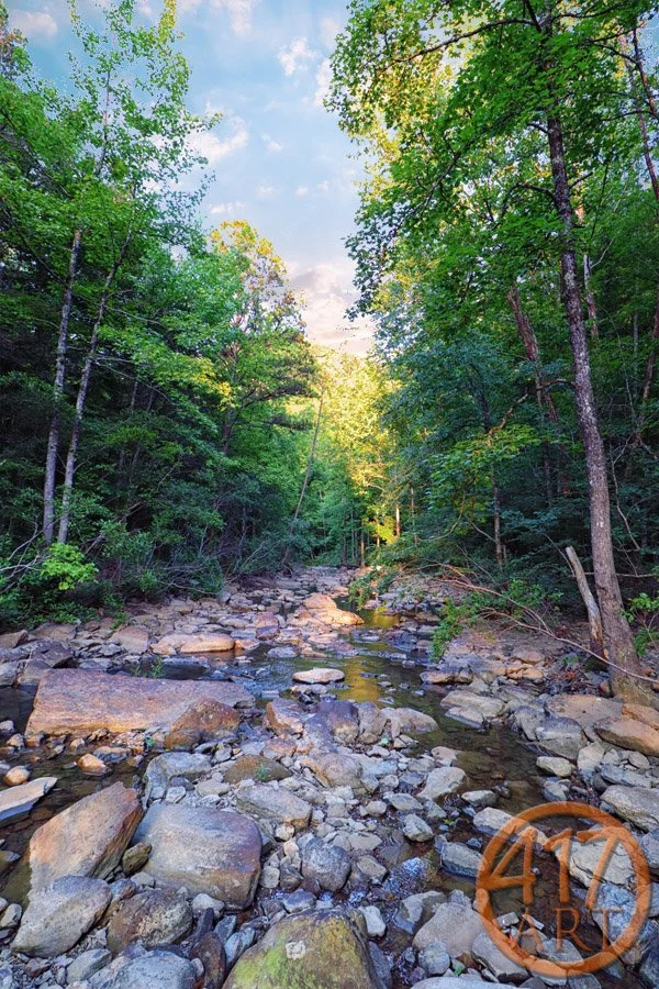
#159 - Pierson Creek
#158 - Lost Hill Park
#157 - Lost Hill Park
#156 - Lost Hill Park
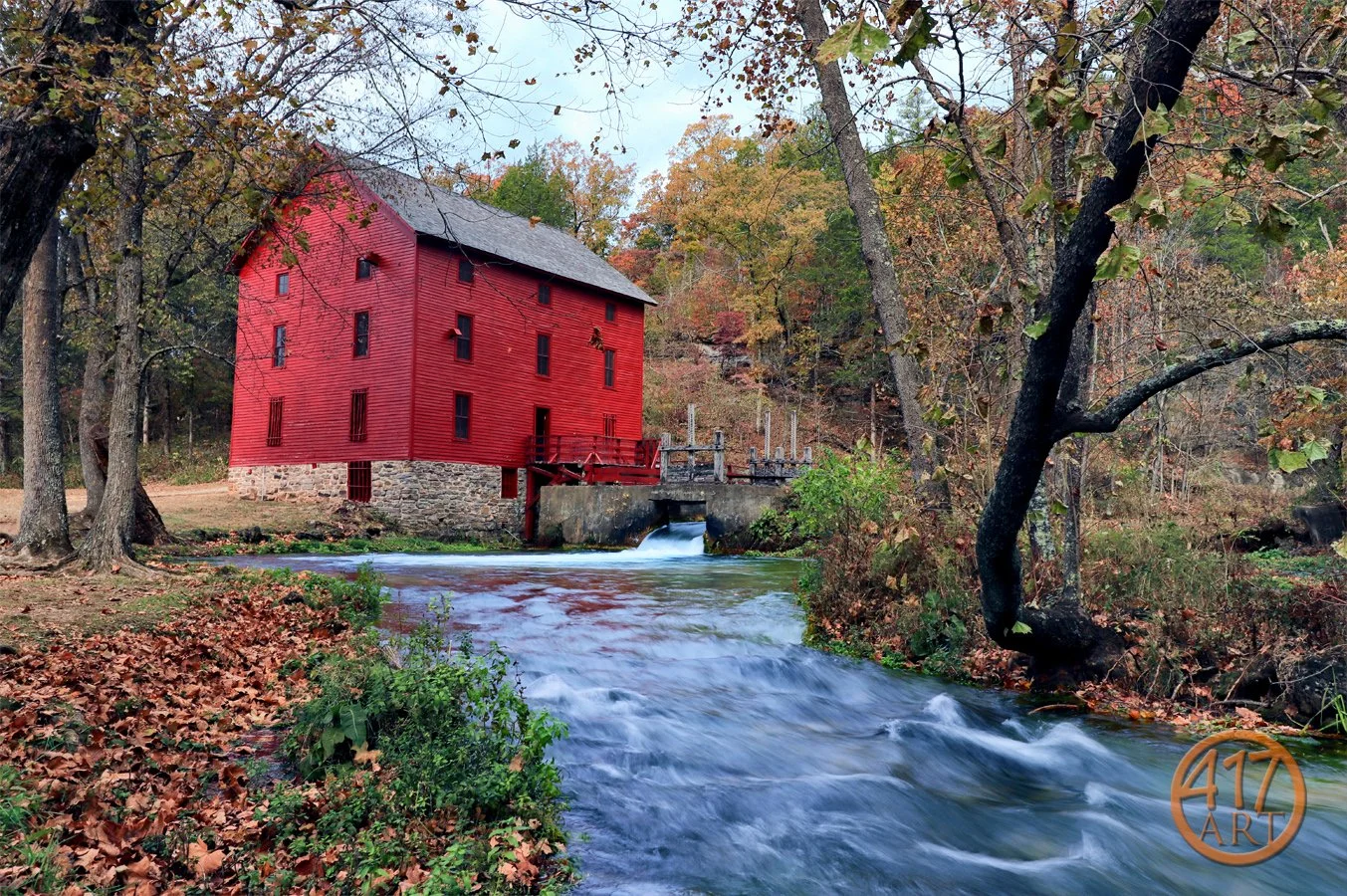
#155 - Alley Spring Mill
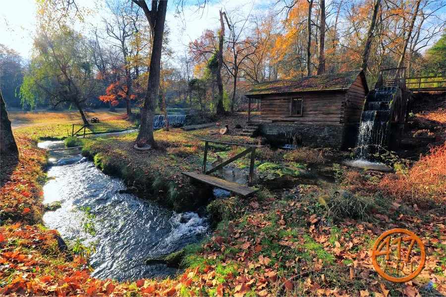
#154 - Reed Spring Mill
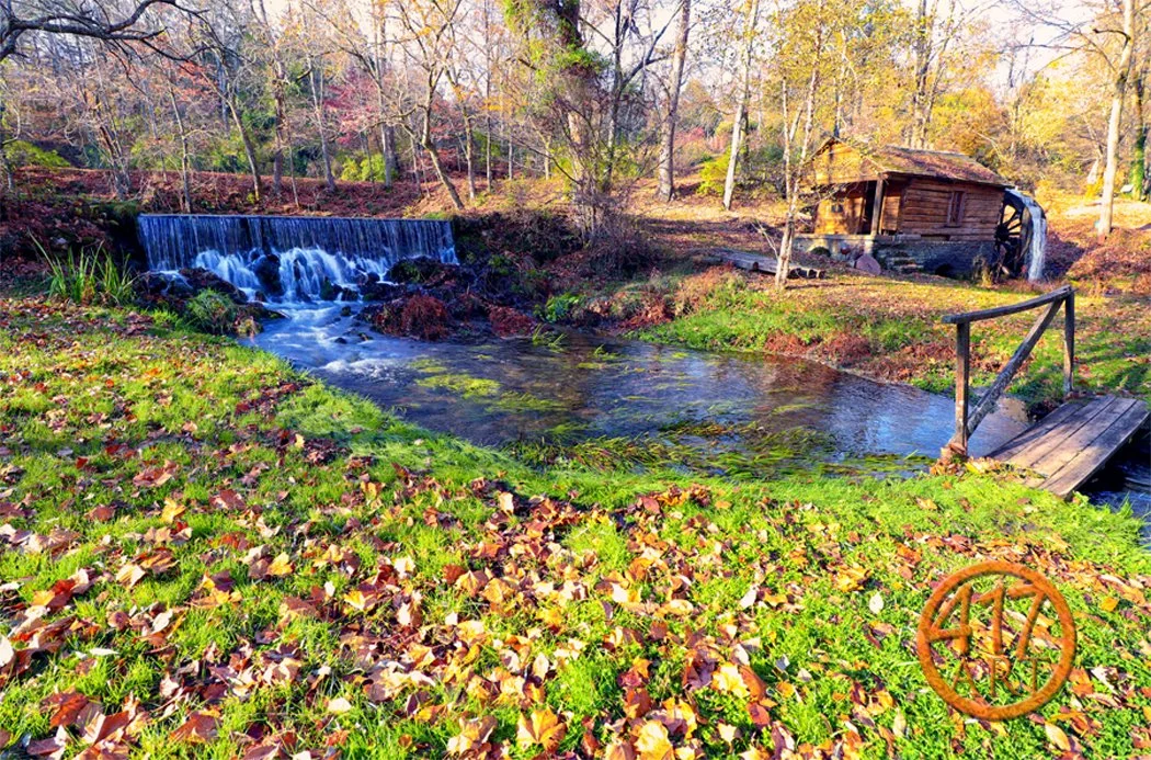
#153 - Reed Spring Mill
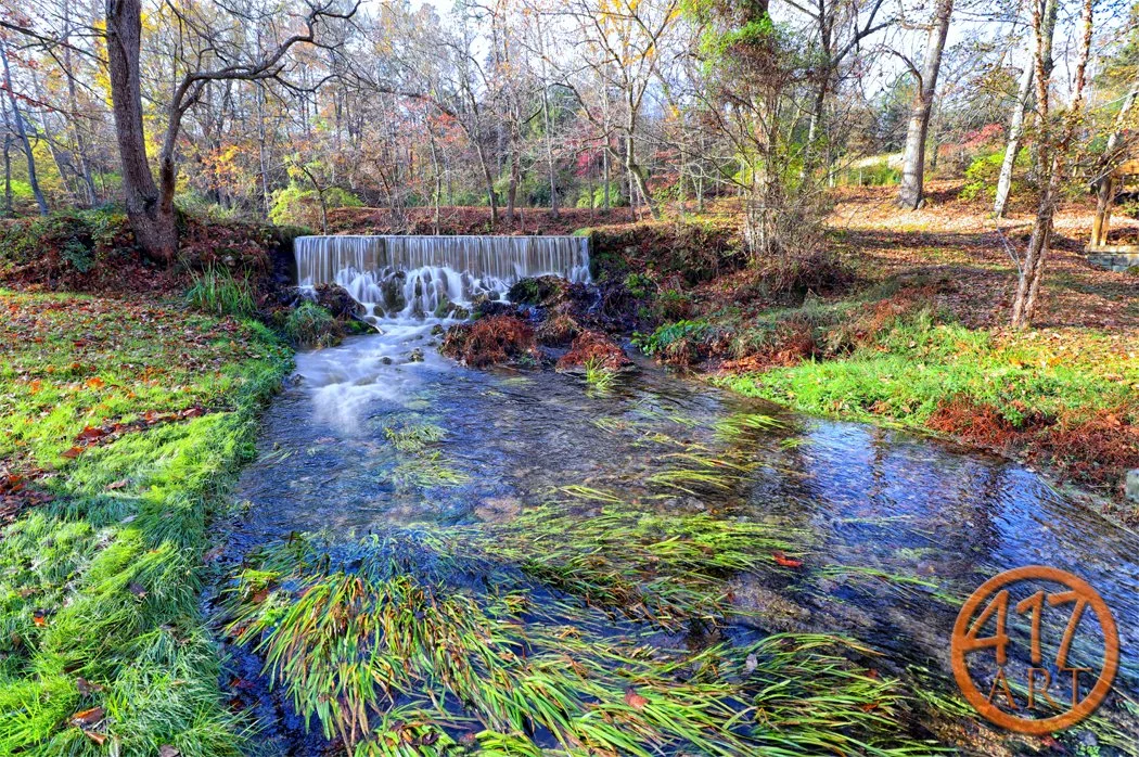
#152 – Reed Spring Mill
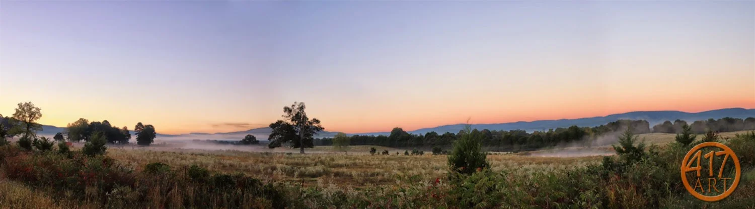
#150 - Witt Springs countryside
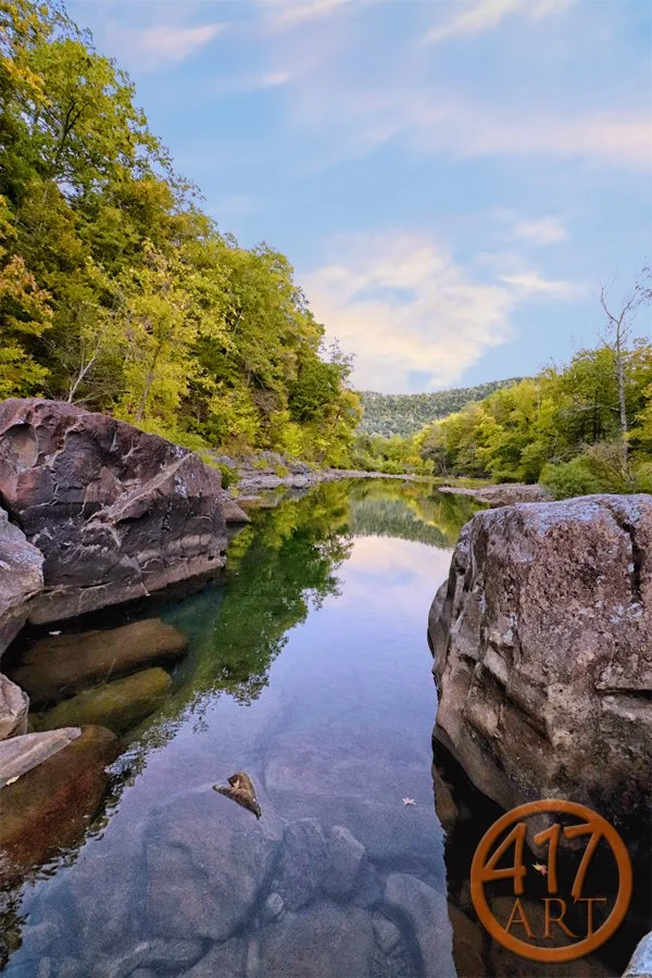
#151 - Richland Creek
#149 - Buffalo River
#148 - Buffalo River
#147 - Haw Creek Falls
#146 - Haw Creek Falls
#145 - Haw Creek Falls
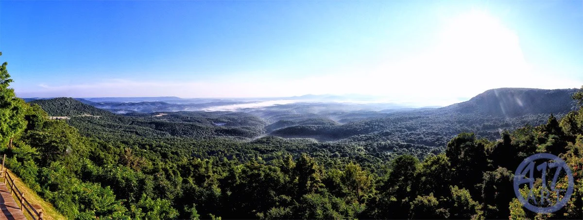
#144 - Arkansas Grand Canyon
#142 - Roaring River State Park
#143 - Roaring River State Park
#141 - Roaring River State Park

#134 - Douglas County Stream

#136 - Douglas County Stars

#131 - Eureka Springs Grand Central Hotel

#129 - Flatiron Building
#001-Downtown Springfield

#124-Triple Falls

#139 - Jones Spring

#138 - Stone Chapel

#121-Thorncrown Chapel

#119-Ha Ha Tonka

#002-Table Rock Lake

#110-Dogwood Canyon

#067-Lindenlure Lake

#012-Jefferson Avenue Foot Bridge

#091-Fordland Flag Barn

#044-Route 66

#030-Whitaker Point

#098-Fordland Star Barn

#003-Wilson's Creek National Battlefield

#045-Gay Parita Sinclair Station

#079-Ozark Hot Air Balloon Glow

#004-Jefferson Avenue Foot Bridge

#065-Lindenlure Lake

#019-Christ Episcopal Church

#046-Sequiota Park

#005-Table Rock Lake

#053-Nature Center Trail

#048-Silver Springs Park

#071-Hammons Field 2017

#070-James River Power Station

#090-Meadowmere Place

#066-Lindenlure Lake

#086-Sunflower Field

#093-Route 66 Rail Haven
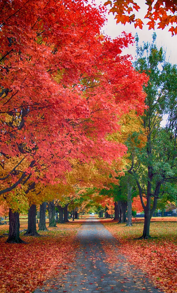
#106 - Maple Park 01

#122-Back Roads

#094-Mediacom Ice Park

#092-Rogersville lane

#069-Lindenlure Lake

#068-Lindenlure Lake

#057-Galloway Creek Bridge
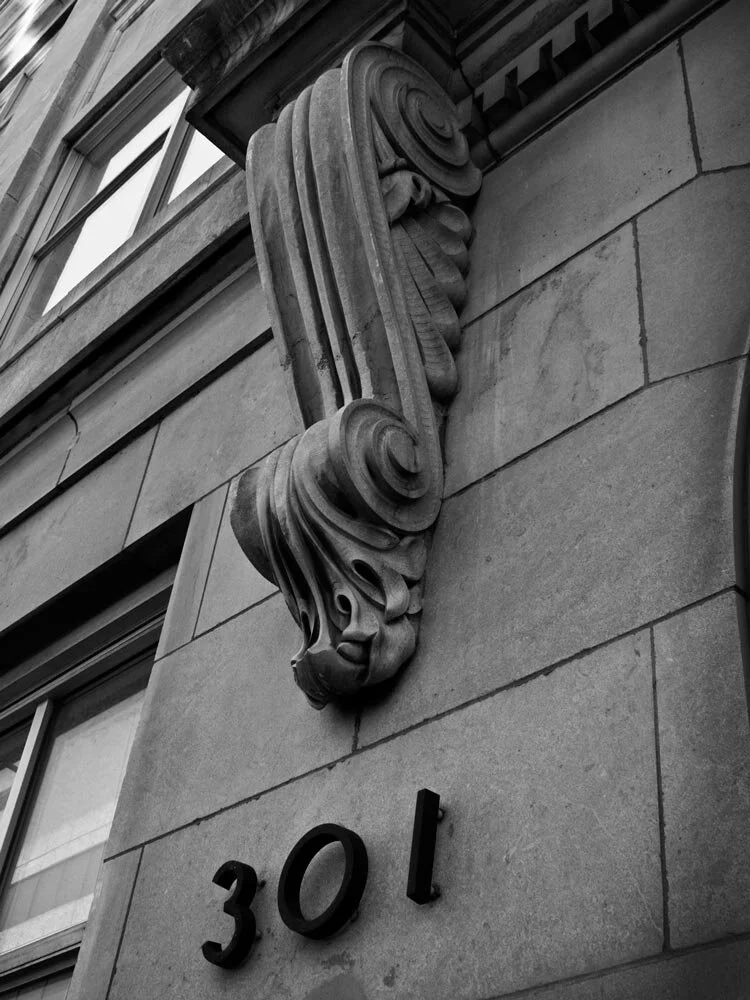
#009-301 South Jefferson

#087-Sunflower Field
#120-Ha Ha Tonka

#140 - University Heights Baptist Church

#052 Nature Center Trail

#130 - Eureka Springs South Main

#103 – Dogwood Canyon Indian Cliff Falls

#111 – Dogwood Canyon

#101 – Indian Bluff

#095 - Hayfield

#096-James River Shelvin Rock

#132 - Strafford Barn

#095-Missouri State Recreation Park

#062-Caspers

#107 – Maple Park

#116-History Museum

#114-Route 66 Fest 01

#006-Ozark Mountains

#125 – James River

#133 - Strafford Barn

#118-Ha Ha Tonka

#113-Dogwood Canyon

#054-Nature Center Trail

#135 - Douglas County Stars

#064-Nathanael Green Park

#112 – Mueller Lake

#098-Sky Eleven

#039-Ozark Mill

#032-Hotel Vandivort

#010-Fassnight Park

#049-Steinert's Farm
#007-Ozark Mountains
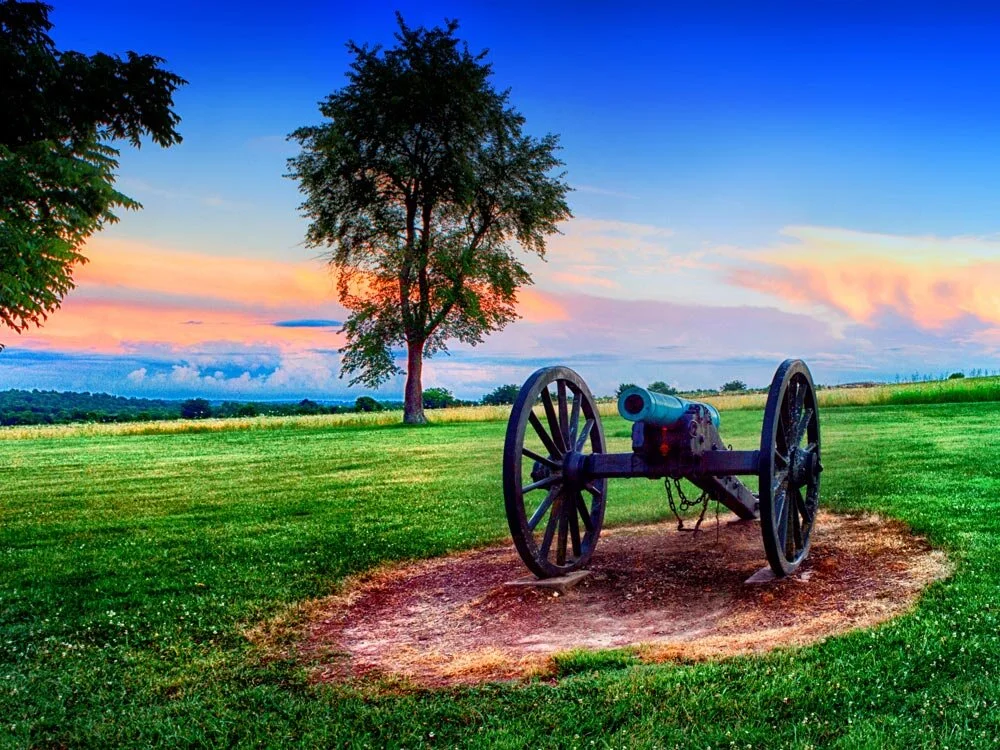
#008-Wilson's Creek National Battlefield

#011-Wilson's Creek National Battlefield

#056-Galloway Creek

#013-GrayCampbell Farmstead

#014-Campbell & Walnut

#015-66 Route 66 Classic Cras

#026-Gillioz Theatre

#017-Old City Hall

#018-Wilsons Creek National Battlefield

#020-Ozark Empire Fair

#021-Ozark Empire Fair

#137 - Dogwood Canyon

#038-Steak n' Shake

#022-Ozark Empire Fair

#025-Fassnight Park

#023-Ozark Empire Fair

#024-Ozark Empire Fair

#027-Gillioz Theatre

#028-Gillioz Theatre

#029-Hammons Field

#031-Herr's Downtown

#033-Juanita K. Hammons Hall

#034-Jordan Valley Park

#035-Jordan Valley Park

#036-Landers Theatre

#037-Lofts Downtown

#040-Downtwn Springfield

#041-Park Central Square

#042-Rivercut Golf Course

#043-Gay Parita Sinclair Station

#050-The Commons At Jordan Valley

#051-Rivercut Golf Course

#055-Camp Winoka

#088-FarmView

#058-Wilson's Creek National Battlefield

#059-Wilson's Creek National Battlefield

#060-Wilson's Creek National Battlefield

#061-Jordan Valley Park

#063 - Doling Park

#072-Springfield Brew Co.

#073-Japanese Stroll Garden

#074-Japanese Stroll Garden

#075-Japanese Stroll Garden

#076-Japanese Stroll Garden

#077-Japanese Stroll Garden

#078-Japanese Stroll Garden

#080-Ritter Springs

#081-Ritter Springs

#082-Ritter Springs

#083-Branson Landing

#084-James River

#085-West Bypass Field

#89-Ozark Barn

#100-Chadwick Farm
#102 – Indian Spring
#104 – Indian Spring

#105 - Lincoln Memorial

#108 - Nathanael Green

#109 - Nathanael Green

#115-Route 66 Fest 02

#117- Flat Creek

#127-Lurvey Corts

#128 – Bois D’Arc Barn

#016-Springfield Art Museum
#165 - Jefferson City#165 - Jefferson City
#164 - Jefferson City#164 - Jefferson City
#163 - Jefferson City#163 - Jefferson City
#162 - Jones Branch#162 - Jones Branch
#161 - Jones Branch#161 - Jones Branch
#160 - Jones Branch#160 - Jones Branch
#159 - Pierson Creek#159 - Pierson Creek
#158 - Lost Hill Park#158 - Lost Hill Park
#157 - Lost Hill Park#157 - Lost Hill Park
#156 - Lost Hill Park#156 - Lost Hill Park
#155 - Alley Spring Mill#155 - Alley Spring Mill
#154 - Reed Spring MillReed Spring Mill
#153 - Reed Spring Mill
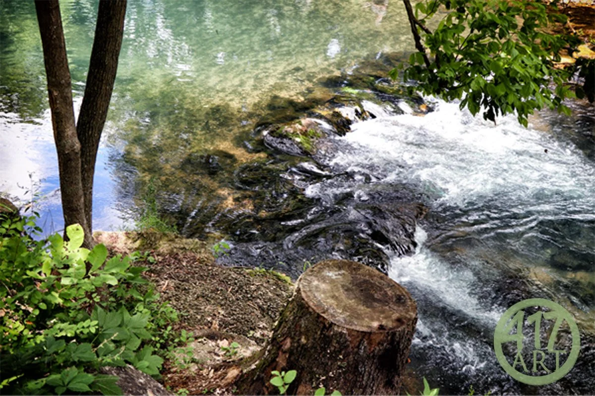
#152 – Reed Spring Mill#152 – Reed Spring Mill A hidden gem in the Ozarks! Reed Spring Mill in Centerville Missouri In 1881, Nathaniel Scott built the dam and grist mill to grind the corn into meal and wheat into flour. Shortly thereafter a saw mill was erected supplying much needed lumber to early settlers to build their homes. This one story non-operating log mill was re built in 1973 as a reproduction of the original mill. The original mill and wheel were taken apart, board by board, and sent to San Francisco for exhibition at the 1939 World’s Fair. This display is now in storage at the Smithsonian Institution in Washington D.C. Although privately owned, this incredibly picturesque mill is fully visible from the road.
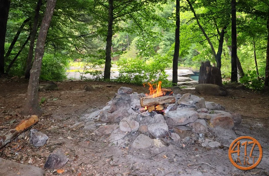
#150 - Witt Springs countryside#150 - Witt Springs countryside
#151 - Richland Creek#151 - Richland Creek
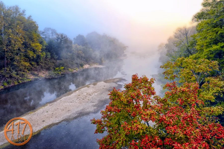
#149 - Buffalo River#149 - Buffalo River
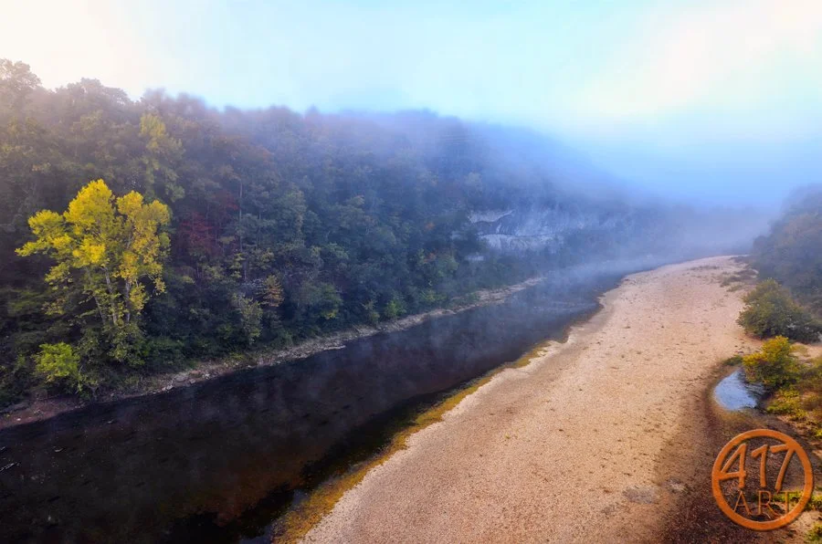
#148 - Buffalo River#148 - Buffalo River
#147 - Haw Creek Falls#147 - Haw Creek Falls
#146 - Haw Creek Falls#146 - Haw Creek FallsHaw Creek Falls is located on a small mountain stream with picturesque falls, rocks, and a bluff. This photo is looking down the creek. The Big Piney Wild and Scenic River is nearby. There is also an accessible trail to the waterfalls. The Ozark Highlands Trail goes through the area. The area is open all year. No fees for camping or day use. Camping allowed in designated sites. There is a low water bridge at the entrance to Haw Creek Falls. located on AR Hwy 123, approx. 12.7 miles South/West of Pelsor (Hwy 7), and approx. 14.5 miles North of Hagarville (Hwy 164).
#145 - Haw Creek Falls#145 - Haw Creek Falls
#144 - Arkansas Grand CanyonArkansas Grand Canyon
#142 - Roaring River State ParkRoaring River State Park
#143 - Roaring River State ParkRoaring River State Park
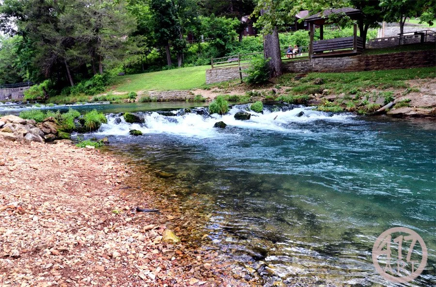
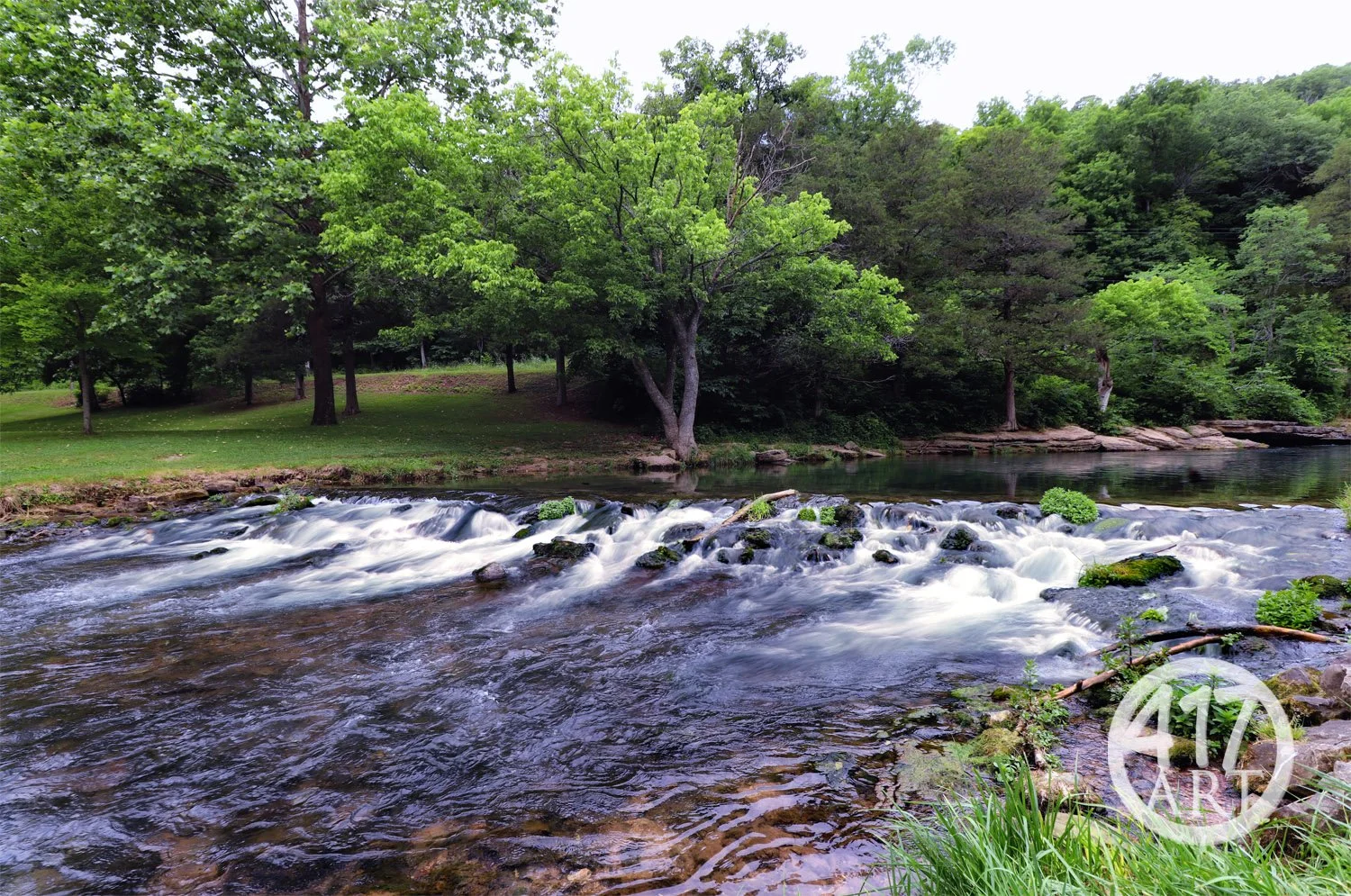
#141 - Roaring River State ParkRoaring River State Park, eight miles south of Cassville in Barry County Missouri. One of Missouri’s most popular state parks, the recreation area covering of 4,294 acres. Land for the park was originally donated by Thomas Mark “Doc” Sayman, a medicine-show man who made millions peddling patent medicines and soaps during his traveling tent shows in the early 20th century. The original park was acquired in 1923, and developed between 1933 and 1939 by the Civilian Conservation Corps and Works Progress Administration. One of three state parks stocked with rainbow trout in Missouri. The park has seven hiking trails, picnic tables for a leisurely lunch and a nature center to learn about the park. The campground has basic, electric and sewer/electric/water site. Rustic cabins are scattered throughout the park, or guests may choose a modern room at the Emory Melton Inn and Conference Center.
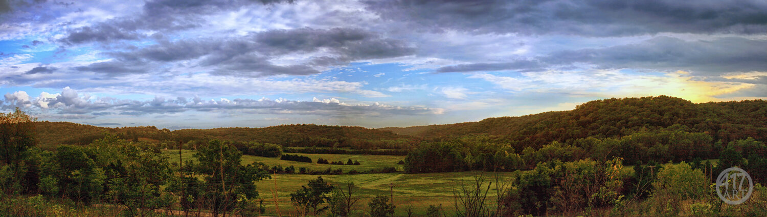
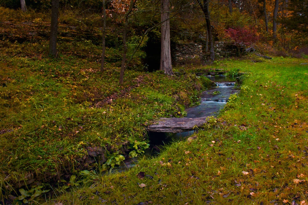
#134 - Douglas County Stream#134 - Douglas County Stream, beautiful slow rolling stream in the Missouri Ozarks. You can always find beauty wherever you look but it helps to be in the right place. Get out there and enjoy the Ozarks and see more like this.
#136 - Douglas County Stars#136 – Douglas County Stars There are some places in Missouri that are very dark with little light pollution. Those places have incredible light displays at night where you can see so many stars!
#131 - Eureka Springs Grand Central Hotel#131 - Eureka Springs Grand Central Hotel.The Grand Central Hotel was originally built in 1880 and served as the stagecoach terminal for passengers coming to Eureka Springs. The Grand Central was first in many ways. It was the first brick hotel in town and it was the first to have running water on every floor.
#129 - Flatiron Building#129 - Flatiron Building On Spring street in Eureka Springs Arkansas you find one of the most photographed building in town. The Flatiron Building. Originally built in 1880, destroyed by fires and re built twice.
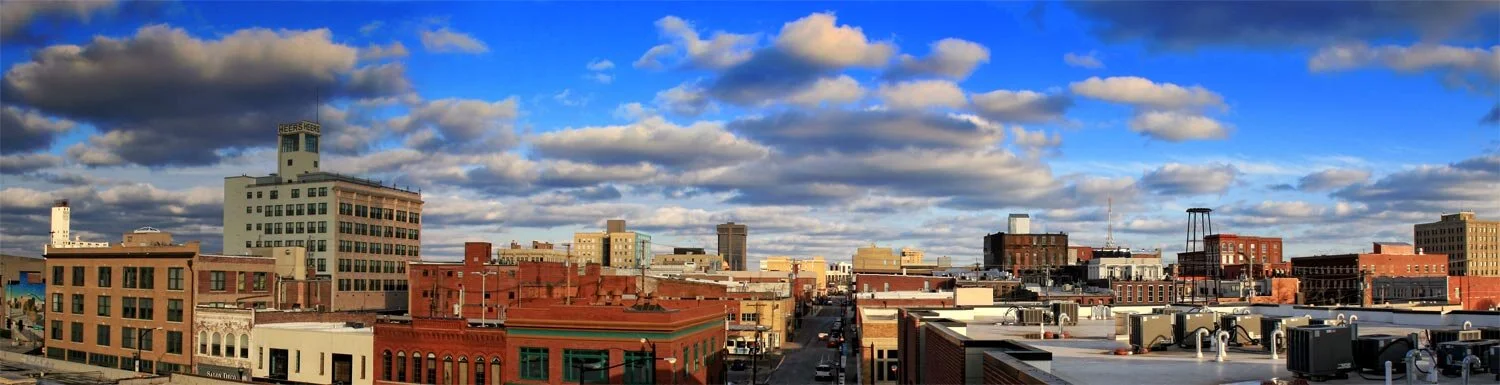
#001-Downtown Springfield#001-Downtown Springfield A view down West McDaniel street in downtown Springfield Missouri. Clouds rolling in on the Ozarks. With a view of the Heer’s building, Hammons Tower and all of the downtown skyline.
#124-Triple FallsWe are lucky to live in an area that has so much beauty. #124 - Triple Falls. The official name is Twin Falls, but in high water it has three distinct falls. Is at Boy Scout camp Orr, near Jasper Arkansas. This 48 ft. tall falls is arguably the most scenic in Arkansas.
#139 - Jones Spring#139 - Jones Spring Located in Springfield, Missouri on Catalpa Street, nestled between some amazing homes you will find Jones Spring. A beautiful spring flowing into Jones Branch and winding through town. Get out there and enjoy the Ozarks
#138 - Stone Chapel#138 - Stone Chapel Drury University in Springfield Missouri. Stone Chapel stands at the northeast corner of Benton Avenue and Central Street. Drury University was founded in 1873 by a group of missionary Congregational pastors. At first the Congregational Church in Springfield and the Opera House were used for classes, but soon Nathan J. Morrison, Drury's first president, conceived the idea of building a chapel that would meet the wider needs of both Drury University and the community.
#121-Thorncrown Chapel#121-Thorncrown Chapel Nestled in a woodland setting, in Eureka Springs, Arkansas, Thorncrown Chapel rises forty-eight feet into the Ozark sky. This magnificent wooden structure contains 425 windows and over 6,000 square feet of glass.Designed by E. Fay Jones and constructed in 1980, the design recalls the Prairie School of architecture popularized by Frank Lloyd Wright, with whom Jones had apprenticed. Thorncrown has won numerous architectural awards.
#119-Ha Ha Tonka#119 – Ha Ha Tonka View down the long flight of stairs leading to the spring at Ha Ha Tonka state park located about 5 miles south of Camdenton Missouri. The Spring Trail at Ha Ha Tonka state park follows the spring with a paved path and then climbs to a wooden boardwalk overlooking the spring with many nooks to take a better view of the stream and the woods all around you.
#002-Table Rock Lake#002-Table Rock Lake Amazing view of Table Rock Lake, from Joe Bald Road near Kimberling City. Get out and enjoy the Ozarks.
#110-Dogwood Canyon#110 – Dogwood Canyon Wonderful waterfall and fall colors at Dogwood Canyon Nature Park in Lampe Missouri just southwest of Branson Missouri. The park covers 10,000-acres of rugged unspoiled Ozarks landscape. The main paved walkway is a 6.2 mile out and back trail featuring, miles of crystal-clear streams, dozens of cascading waterfalls, unique hand-built bridges, and bottomless, blue-green pools.
#067-Lindenlure Lake#067-Lindenlure Lake Early morning fog on the Finley River at Lindenlure lake, near Rogerville MO. A popular swimming spot in the Ozarks.
#012-Jefferson Avenue Foot Bridge#012-Jefferson Avenue Foot Bridge Springfield’s 117-year-old footbridge was closed March 1, 2016. I captured this shot right before it was closed. The Jefferson Avenue Footbridge was built in 1902 and is on the National Register of Historic Places.
#091-Fordland Flag Barn#091 - Fordland Flag Barn Timing is everything in photography…timing and location. And what a location! This beautiful setting with this patriotic barn sits outside Fordland Missouri.
#044-Route 66#044-Route 66 The mother road, main street of America, old US route 66! One of the original highways within the US highway system. US 66 was established on November 11, 1926. Missouri was the first state to erect a historic marker on US 66. It is located at Kearney Street and Glenstone Avenue here in Springfield. Take a drive just west of Halltown Missouri to see one of the only shields painted on the road in the Ozarks.
#030-Whitaker Point#030-Whitaker Point
#098-Fordland Star Barn#098-Fordland Star Barn An old barn just outside of Fordland Missouri created a wonderful foreground to the night sky during the new moon over the weekend. This was my first attempt at light painting a building and capturing the starry sky at the same time. This took several hours of shooting to get all of the elements and many more to find the right location. But it all came together to create a dramatic photograph.
#003-Wilson's Creek National Battlefield#003-Wilson's Creek National Battlefield Wilson's Creek National Battlefield near Republic, Missouri, preserves the site of the Battle of Wilson's Creek. Fought on August 10, 1861. It was the first major American Civil War engagement west of the Mississippi River. At Sigel's Final Position. An interesting fact, The Wire Road is named for the telegraph wire strung alongside the road that ran from Springfield to Fort Smith, Arkansas.
#045-Gay Parita Sinclair Station#045-Gay Parita Sinclair Station Located 25 miles west of Springfield on historic route 66 in Paris Junction, Missouri. Built by Gary Turner, the station was a re-creation of a circa-1930 gas station owned by Fred and Gay Mason that stood in the same spot until it burned down in 1955. Fred named the jumble of art deco gas stations after his wife Gay, and over the years, it became one of the favorite stops along Route 66. Gary’s guest book has been signed by travelers from as far away as New Zealand, Russia, China, India, Lithuania, Denmark, Italy and France. Sadly, Gary Turner, proprietor of The Gay Parita service station, passed away in January 2015. The site includes a replica station, along with original pumps and other memorabilia from the heyday of Route 66. If you have the time you should stop by this major stop along the mother road.
#079-Ozark Hot Air Balloon Glow#079-Ozark Hot Air Balloon Glow To help take your mind off of the gloomy weather today, here are some hot air balloons! Annual Hot Air Balloon Glow at Finley River Park in Ozark, Missouri. The hot air balloons are tethered to the ground so all attendees can get close to the balloons, get in the baskets and help keep them inflated!
#004-Jefferson Avenue Foot Bridge#004-Jefferson Avenue Foot Bridge
#065-Lindenlure Lake#065-Lindenlure Lake I don’t think I have ever shared this photo. Taken a few years ago, early morning fog on the Finley River at Lindenlure lake, near Rogerville MO. A popular swimming spot in the Ozarks.
#019-Christ Episcopal Church#019-Christ Episcopal Church
#046-Sequiota Park#046-Sequiota Park Sequiota is an Indian name, Se-qui-o-ta meaning many springs. The park was used once as the Kickapoo Prairie Indian gathering grounds. Sequiota Park is part of the Galloway Station area in Springfield, Missouri. The area is named Galloway Station after Civil War Veteran Major Galloway. When Galloway was a merchant he stored goods in the cave. In the 1920's and 30's Sequiota Cave was used to raise mushrooms and later became a show cave with guided boat tours. The park was made into a State Park in 1929. Until 1959 it was used as a fish hatchery. After that, the city of Springfield bought the park and made it a city park.
#005-Table Rock Lake#005-Table Rock Lake
#053-Nature Center Trail#053-Nature Center Trail
#048-Silver Springs Park#048-Silver Springs Park Park Day Reunion takes place Aug. 3-5 from 10:00 a.m.-8:00 p.m. at Silver Springs Park. Back when Springfield was segregated, Silver Springs Park was the only park open to African Americans and black churches baptized their congregants at the park. The annual gathering brings together friends and family from Springfield and around the country. The event started in 1952, when Gerald Brooks, a teacher at Lincoln School, started a day of games for young African Americans at Silver Springs Park.
#071-Hammons Field 2017#071-Hammons Field 2017
#070-James River Power Station#070-James River Power Station Lake Springfield was created in 1957 with the construction of a dam on the James River. The city of Springfield purchased the land before it was submerged. It cost $11.1 million to buy the land and build the dam to create the lake and first two units of the power station. The lake was to be a cooling reservoir for the James River Power Station. Construction on the first two units of the power plant was started in 1957. Three more units were added to the power station by 1970. Water from the lake was used to cool the steam generators. The generators were originally constructed to burn natural gas but the federal Fuel Use Act of 1978 forced it to switch to coal. The generator units had a life expectancy of 30 years. In 2015, the power plant was slated to be shut down. The original three generators have already been discontinued.
#090-Meadowmere Place#090 Meadowmere Place In central Springfield Missouri, you can find this historic neighborhood. It's located in the Rountree area, with beautiful homes and wonderful tree-lined streets. Early fall morning catching the vivid fall colors and light fog.
#066-Lindenlure Lake#066-Lindenlure Lake
#086-Sunflower Field#086 - Sunflower Field Just west of Springfield Missouri you will find this wonderful sunflower field. Some interesting facts about sunflowers. • The spiral formation of seeds in a sunflower almost always follows the Fibonacci sequence. • A single sunflower can have up to 2000 seeds. • Sunflower seeds are found in two ways black and striped. • Black seeds are used to make oil and snacks are made out of striped seeds.
#093-Route 66 Rail Haven#093-Route 66 Rail Havenlisted on the National Register of Historic Places was built in 1938, the heyday of The Mother Road, when brothers Elwyn and Lawrence Lippman built eight sandstone cottages on their grandfather’s apple orchard along Route 66 in Springfield, Missouri, and accented the property with a rail fence. By 1946 the motel had grown to 28 rooms. In the early 1950s, it became part of the newly formed Best Western chain of motels. The property went through many upgrades from the mid-1950s to the early 1970s, including changing from cottages to a strip motel. Elvis Presley crashed in room 409 at the Rail Haven. A full-service gas station with a two-tabled diner was on the current site of the motel office. Today, the Rail Haven celebrates that heritage with ornamental gas pumps that sit in front of the retro sandstone-colored rock facade of the office and dinner. The Rail Haven office still has its original working phone booth with a rotary dial.
#106 - Maple Park 01#106 - Maple Park 01
#122-Back Roads#122-Back Roads There are some great areas in the Ozarks with beautiful scenery. In south Springfield, MO you can find roads like this and if you catch it at the right time it can be very serene.
#094-Mediacom Ice Park#094-Mediacom Ice Park Last spring in downtown Springfield MO. On East Trafficway with the trees budding and traffic going by. Looking forward to all the spring flowers and trees this year.
#092-Rogersville lane#092-Rogersville laneA foggy fall morning just north of Rogersville Missouri. Beautiful lane lined with fall trees. Stop and enjoy what the Ozarks can offer.
#069-Lindenlure Lake#069 Lindenlure Lake I was able to take some wonderful shots of Lindenlure Lake, in Christian County Missouri a few years ago. Beautiful spot, but unfortunately the access is no longer open to the public.
#068-Lindenlure Lake#068-Lindenlure Lake
#057-Galloway Creek Bridge #057-Galloway Creek Bridge Galloway Creek and is part of James River Greenway trail. It begins at Pershing Middle School on Seminole Street, just east of Lone Pine Avenue, and heads south through historic Sequiota Park and the village of Galloway, then to the Springfield Conservation Nature Center, concluding at the scenic James River bridge. If you get a chance, please take advantage of the wonderful nature trails that this area has to offer!
#009-301 South Jefferson #009-301 South Jefferson Downtown Springfield Missouri has some amazing architecture. As you are enjoying the unique shops and restaurant’s take a moment to look up. You might be surprised at what you will see. (#009) 301 South Jefferson building, part of Missouri State the Jim D. Morris Center for Continuing Education was built in 1912.
#087-Sunflower Field#087-Sunflower Field
#120-Ha Ha Tonka #120-Ha Ha Tonka View over Devils Kitchen at Ha Ha Tonka State Park This park is about five miles south of Camdenton, Missouri, encompassing over 3,700 acres on the Niangua arm of the Lake of the Ozarks. It is a geologic wonderland featuring sinkholes, caves, a huge natural bridge, sheer bluffs and Missouri’s 12th largest spring. A series of trails and boardwalks makes it easy for visitors to experience all the park has to offer, from its historic castle and geologic wonders to its wooded areas and open rocky glades.
#140 - University Heights Baptist Church #140 - University Heights Baptist Church On the corner of Grand and National, right across from Missouri State University in Springfield Missouri you will find University Heights Baptist Church. This impressive stone church is a staple for the local community and a beauty to see.
#052 Nature Center Trail #052 Nature Center Trail Located at Springfield’s Conservation Nature Center, this photo is along one of the 3 miles of trials featured at the center, and winds next to Springfield Lake. Within the city limits of Springfield Missouri you will find 80-acres dedicated to Ozarks nature. Including educational and informative programs and events; nature and conservation exhibits. The visitor center building includes a self-guided exhibit area, a gift shop, a 150-seat auditorium, classrooms and restrooms.
#130 - Eureka Springs South Main#130 - Eureka Springs South Main. Early morning sunrise!
#103 – Dogwood Canyon Indian Cliff Falls #103 – Dogwood Canyon Indian Cliff Falls This is the main waterfall and the first you will see when entering Dogwood Canyon Nature Park. The park covers 10,000-acres of rugged unspoiled Ozarks landscape near Lampe, Missouri. The main paved walkway is a 6.2 mile out and back trail featuring, miles of crystal-clear streams, dozens of cascading waterfalls, unique hand-built bridges, and bottomless, blue-green pools.
#111 – Dogwood Canyon #111 – Dogwood Canyon Cascading waterfalls all over at Dogwood Canyon Nature Park in Lampe Missouri just southwest of Branson Missouri.
#101 – Indian Bluff #101 – Indian Bluff An amazing spot along the James River in Green County Missouri. On the south side of Springfield close to Rivercut Golf Course, you will see this wonderful bluff with a view of the James River.
#095 - Hayfield #095 - Hayfield Just east of Springfield Missouri I came across this hayfield. Taking a moment to capture this with the beautiful sunset and geese flying south for the winter. It was a quiet field although left abandoned it has its own unique beauty.
#096-James River Shelvin Rock #096-James River Shelvin Rock Just south of Nixa Missouri you will come across Shelvin Rock Access. A Missouri Conservation Department fishing access, along the James River. This area has a great gravel bar and includes a boat ramp. A great area to start a float trip or just spend a hot day on the bank.
#132 - Strafford Barn #132 - Strafford Barn Just North of Strafford Missouri you will find some amazing landscapes. The owner of the property allowed me to take photos of there beautiful barn. I had to spend some time with the cows but was able to capture a few night shots. I used a gel with my flash set up to get a little creative color on the inside of the barn.
#095-Missouri State Recreation Park #095-Missouri State Recreation Park Spent some time at Missouri State Recreation Fields. And I was able to get this photo along with some long exposure photos. I hope you enjoy. The Betty and Bobby Allison Recreation Fields include two sand volleyball courts and two multipurpose turf fields located just south of Harrison and National in Springfield Missouri.
#062-Caspers#062-Caspers
#107 – Maple Park #107 – Maple Park Beautiful fall colors frame the gazebo at Maple Park Cemetery. The gazebo has gone under some reconstruction to keep it to its original shape and help it last for many more years. The gazebo is believed to be original to the cemetery from 1876 which would make it one of the oldest frame structures in Springfield Mo.
#116-History Museum #116-History Museum History Museum on the Square honors Springfield's past, including the Birthplace of Route 66 and the site of the first Wild West shootout. The 18,000-square-foot location, which features seven galleries, including six permanent exhibits and one state-of-the-art gallery for special events and traveling exhibits. Where is this? 154 Park Central Square, Springfield, MO.
#114-Route 66 Fest 01 #114-Route 66 Fest 01 Birthplace of Route 66 Festival. Route 66 traveled through the Springfield Mo. from Kearney Street to Glenstone Avenue to St. Louis Street, through Park Central Square to Olive and College streets, then headed west along what is now Chestnut Expressway. This photo was taken on Park Central East in front of the Iconic Gillioz theater with some of the crowed looking on. Springfield is officially recognized as the birthplace of what became known as the iconic "Mother Road." It was on April 30, 1926.
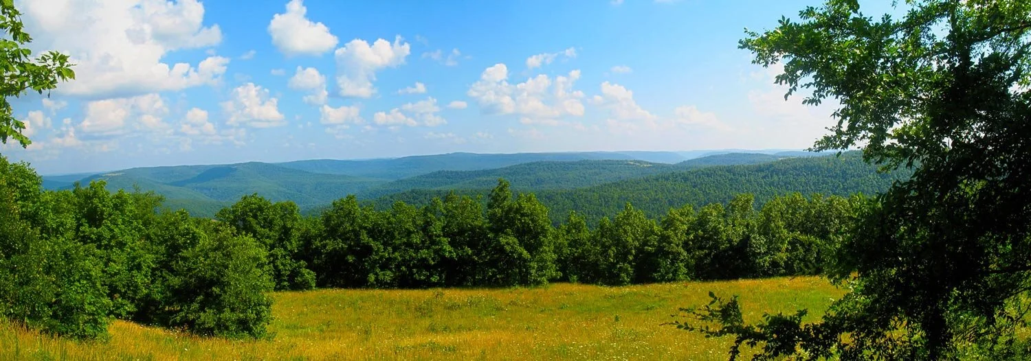
#006-Ozark Mountains #006-Ozark Mountains The Ozark mountains in North West Arkansas provided a stunning backdrop to everyone in the area. The Ozarks cover a significant portion of northern Arkansas and southern Missouri, the mountains occupy an area of about 50,000 square miles, of which 33,000 square miles are in Missouri, 13,000 square miles in northern Arkansas. The highest peaks, many exceeding 2,000 feet, are home to secluded cabins, sparkling rivers, and beautiful waterfalls!
#125 – James River #125 – James River The James River just outside of Springfield Mo. The source starts northeast of the town of Seymour in Webster County and eventually enters Table Rock Lake, a reservoir on the White River.
#133 - Strafford Barn #133 - Strafford Barn Just North of Strafford Missouri you will find some amazing landscapes. The owner of the property allowed me to take photos of there beautiful barn. I had to spend some time with the cows but was able to capture a few night shots. I used a gel with my flash set up to get a little creative color on the inside of the barn.
#118-Ha Ha Tonka #118-Ha Ha Tonka Mist over Trout Glen Pool at Ha Ha Tonka State Park This park is about five miles south of Camdenton, Missouri, encompassing over 3,700 acres on the Niangua arm of the Lake of the Ozarks. It is a geologic wonderland featuring sinkholes, caves, a huge natural bridge, sheer bluffs and Missouri’s 12th largest spring. A series of trails and boardwalks makes it easy for visitors to experience all the park has to offer, from its historic castle and geologic wonders to its wooded areas and open rocky glades.
#113-Dogwood Canyon#113-Dogwood Canyon
#054-Nature Center Trail#054-Nature Center Trail
#135 - Douglas County Stars#135 – Douglas County Stars There are some places in Missouri that are very dark with little light pollution. Those places have incredible light displays at night where you can see so many stars! I was able to camp at one of these locations in Douglas County and was treated with a great starry night.
#064-Nathanael Green Park#064-Nathanael Green Park
#112 – Mueller Lake #112 – Mueller Lake Mueller lake just outside of Strafford Missouri. This lake is man-made by Paul Mueller on their property with many rolling Ozarks’ hills and several other lakes. I hope you enjoy and get out there and see what the Ozarks has to offer.
#098-Sky Eleven #098-Sky Eleven The Woodruff Building opened in 1911, Developed by John T. Woodruff and designed by Frank W. Hunt, the ten-story structure was christened ‘Springfield’s first Skyscraper’. It became a Springfield landmark of both downtown and of the skyline. An ornate brick exterior and an interior of Italian marble and intricate tile detailing. The post-WW II boom and expansion helped launch the concept of ‘modernization’ in all things. The Woodruff Building saw its first substantial ‘makeover’ during this time. Embracing modernism, the top parapet cap was removed and the entire exterior clad in sleek, blue porcelain panels. In 2014, the Vecino Group—with a goal of again creating a meaningful corner of downtown, acquired the Woodruff Building. As ‘Sky Eleven’ (an homage to its original nickname and birth year) it is a key part of the Park East neighborhood—and once again a vibrant part of Springfield.
#039-Ozark Mill#039-Ozark MillOzark Mill “Hoover’s Mill” Before the Civil War there was an important trail that came down from Springfield to Forsyth, "Wagon Road" that crossed over the Finley River at the site of the mill. The Ozark mill was built in 1833 by James Kimberling, Sr. The Ozark community sprang up around Hoover's Mill or the Ozark Water Mill. The mill was a designated polling place and the center of news, socialization and commerce-where townspeople plotted politics, started or settled disputes and exchanged money for goods and services. The town was originally named Hoover's Mill in 1839 after the mill's owner, John Hoover, and a year later, Hoover's Mill became the town of Ozark. The mill, now owned by Bass Pro Shops stands today as a tangible link to the past.
#032-Hotel Vandivort#032-Hotel Vandivort
#010-Fassnight Park #010-Fassnight Park A 28-acre plot purchased by the Springfield Park Board in 1924. The Springfield Park Board concluded a deal for 28 acres of the Fassnight farm south of Springfield, paying $12,000. One of the stipulations of the purchase was that the name Fassnight be used for the park. Fassnight was added to and made more attractive during the Great Depression by the WPA program. The pool building, walls, walkways, retaining walls, bridges, barbecue pits and even a creek bed line for Fassnight Creek, featuring Ozark Limestone were all added at this time. Fassnight Creek winds through the wooded park and hosts a variety of wildlife and native plantings.
#049-Steinert's Farm#049-Steinert's Farm
#007-Ozark Mountains#007-Ozark Mountains
#008-Wilson's Creek National Battlefield#008-Wilson's Creek National Battlefield
#011-Wilson's Creek National Battlefield#011-Wilson's Creek National Battlefield
#056-Galloway Creek #056-Galloway Creek The view off of the old iron bridge on Galloway Creek greenway trail. Nearly six miles of Galloway Creek Greenway wind north-south through the east side of Springfield, Missouri. The first urban trail to be designated a National Recreation Trail, this greenway has become a backbone for recreation and bicycle transportation in the community. Connecting two schools, a historic park and cave, an award-winning nature center, many neighborhoods, several churches and some great restaurants including the popular local favorite, Galloway Station Bar & Grill.
#013-GrayCampbell Farmstead#013-GrayCampbell Farmstead
#014-Campbell & Walnut#014-Campbell & Walnut
#015-66 Route 66 Classic Cras#015-66 Route 66 Classic Cras
#026-Gillioz Theatre#026-Gillioz Theatre
#017-Old City Hall#017-Old City Hall
#018-Wilsons Creek National Battlefield #018-Wilsons Creek National Battlefield A corn field at Wilson's Creek National Battlefield just outside Republic, Missouri is lined with the traditional civil war style split-rail fence and the clouds are rolling out just after a storm.
#020-Ozark Empire Fair#020-Ozark Empire Fair
#021-Ozark Empire Fair#021-Ozark Empire Fair
#137 - Dogwood Canyon#137 - Dogwood Canyon
#038-Steak n' Shake #038-Steak n' Shake S Glenstone Ave, Springfield, MO. This location was built in 1962 and still has the original building and sign. Was lucky enough to have a classic mustang to pose out front. Steak 'n Shake was founded in 1934 in Normal, IL. It was immediately successful with its Steakburgers made from real steak and its Tru-Flavor shakes. Steak 'n Shakes offered "four way service": service at tables and counters inside, curb service, and takeout. The chain's motto "In Sight, it Must Be Right" referred to its highly visible food preparation. In the late 1930s, Steak 'n Shake expanded to St. Louis, Indianapolis, northern Illinois, Daytona Beach, FL and Hot Springs, AR. By 1975, there were 130 locations. During the 1970s, car hops and curb service were replaced with drive-thru windows. There are now more than 400 locations in 19 states.
#022-Ozark Empire Fair#022-Ozark Empire Fair
#025-Fassnight Park #025-Fassnight Park 1301 South Campbell Ave. Springfield MO. A 28-acre plot purchased by the Springfield Park Board in 1924. The Springfield Park Board concluded a deal for 28 acres of the Fassnight farm south of Springfield, paying $12,000. One of the stipulations of the purchase was that the name Fassnight be used for the park. Fassnight was added to and made more attractive during the Great Depression by the WPA program. The pool building, walls, walkways, retaining walls, bridges, barbecue pits and even a creek bed line for Fassnight Creek, featuring Ozark Limestone were all added at this time. Fassnight Creek winds through the wooded park and hosts a variety of wildlife and native plantings. Please take the time and visit this park if you are in the area. You will not be disappointed.
#023-Ozark Empire Fair#023-Ozark Empire Fair
#024-Ozark Empire Fair#024-Ozark Empire Fair
#027-Gillioz Theatre#027-Gillioz Theatre
#028-Gillioz Theatre #028-Gillioz Theatre The Gillioz Theatre, one of the Midwest’s great old theatres is located on historic Route 66 in the Springfield Public Square Historic District. It was built by M. E. Gillioz of Monett, Missouri. Mr. Gillioz was a well-known builder and developer in southwest Missouri. He financed and built the theatre, which was named in his honor. Mr. Gillioz was in the business of building bridges, and the theater was built with steel and concrete. Wood was only used for handrails, doors, and doorframes. The original cost of the building was $300,000. The theater opened on October 11, 1926, to tremendous acclaim. The sold-out crowd was enchanted by the opulent Spanish Colonial Revival design, and modern visitors are equally impressed today. The theater was originally a transition theater, with a pipe organ for silent movies and a stage for live performances, such as vaudeville acts. A sound system was installed in 1928 with the advent of talkies. Now the Gillioz is mainly a concert venue, hosting a wide range of entertainment anyone can enjoy. It was listed on the National Register of Historic Places in 1991.
#029-Hammons Field#029-Hammons Field
#031-Herr's Downtown#031-Herr's Downtown
#033-Juanita K. Hammons Hall#033-Juanita K. Hammons Hall
#034-Jordan Valley Park#034-Jordan Valley Park
#035-Jordan Valley Park#035-Jordan Valley Park
#036-Landers Theatre#036-Landers Theatre
#037-Lofts Downtown#037-Lofts Downtown
#040-Downtwn Springfield #040-Downtwn Springfield This long exposure was taken from the fountain on Park Central Square. Formerly Trolley’s, owned by Aaron Buerge who appeared on ABC “The Bachelor”. Now home to Civil Kitchen.
#041-Park Central Square#041-Park Central Square
#042-Rivercut Golf Course#042-Rivercut Golf Course
#043-Gay Parita Sinclair Station#043-Gay Parita Sinclair Station
#050-The Commons At Jordan Valley#050-The Commons At Jordan Valley
#051-Rivercut Golf Course#051-Rivercut Golf Course
#055-Camp Winoka#055-Camp Winoka
#088-FarmView #088-FarmView East of Springfield on a gravel road was this view. As I was setting up to take this shot a horse drawn cart rode by, unfortunately I was too late to capture that. I was able to capture this as the storm was leaving and you can see most of the clouds in the distance.
#058-Wilson's Creek National Battlefield#058-Wilson's Creek National Battlefield
#059-Wilson's Creek National Battlefield#059-Wilson's Creek National Battlefield
#060-Wilson's Creek National Battlefield#060-Wilson's Creek National Battlefield
#061-Jordan Valley Park #061-Jordan Valley Park A showpiece of Downtown Springfield. Jordan Valley includes jumping fountains and stream, shaded picnic area, walking trail, outdoor amphitheater, unique children's play features, the K-Man interactive sculpture and pieces from the Springfield Sculpture Walk. Jordan Valley Park is adjacent to Jordan Valley Ice Park, Hammons Field and the Creamery, home of the Springfield Regional Arts Council. located in the heart of Springfield at 635 East Trafficway, is an urban meadow vast enough to find places for solitude and places to socialize.
#063 - Doling Park #063 - Doling Park in Springfield Missouri, entrance to the Giboney cave. Doling Park stands at the intersection of Talmage and Campbell in northern Springfield. The first settlers to own the land called Doling Park were John Thomas Giboney and his brother James Giboney. They purchased the 40-acre tract in 1846 for $60. The park was named for James Marshall Doling, who came to Springfield from Paris and Gallatin, Missouri. In 1907 a group of three Springfield businessmen, Charles Brooks, William H. Jezzard and Ben E. Meyer, calling themselves "The Springfield Amusement Company," purchased Doling Park from James Doling for $50,000. This began the heyday period of the park. William H. Jezzard eventually bought controlling interest in the company and sold Doling Park to the City of Springfield in 1929 for $85,000. In the 1960s and 1970s roller skating was the big draw to Doling Park. In the 1970s the last of the rides were removed. The roller rink was turned into the Northview Leisure Center, later the Northview Community Center. The dance hall is now Doling Community Center.
#072-Springfield Brew Co.#072-Springfield Brew Co.
#073-Japanese Stroll Garden#073-Japanese Stroll Garden
#074-Japanese Stroll Garden#074-Japanese Stroll Garden
#075-Japanese Stroll Garden#075-Japanese Stroll Garden
#076-Japanese Stroll Garden#076-Japanese Stroll Garden
#077-Japanese Stroll Garden#077-Japanese Stroll Garden
#078-Japanese Stroll Garden#078-Japanese Stroll Garden
#080-Ritter Springs#080-Ritter Springs
#081-Ritter Springs#081-Ritter Springs
#082-Ritter Springs#082-Ritter Springs
#083-Branson Landing#083-Branson Landing
#084-James River #084-James River On old state highway D just outside of Springfield Missouri you will find an abandoned iron bridge. This area has a great view of the tree lined James River. The James River is 130 miles long and flows from northeast Webster County until it is impounded into Table Rock Lake. It is part of the White River watershed. The river forms Lake Springfield and supplies drinking water for the city of Springfield.
#085-West Bypass Field#085-West Bypass Field
#89-Ozark Barn #89-Ozark Barn This rustic old barn sits in the town of Ozark amongst some great houses. You would not expect to find a beautiful old barn like this where it sits. Just some of the great finds in and around 417 land.
#100-Chadwick Farm #100-Chadwick Farm South of Chadwick Missouri, along a quiet back road you will come across a peaceful field nestled in the hills. A beautiful area with many rolling hills and natural springs. I plan on visiting this area more to capture some hidden gems like this field in the future.
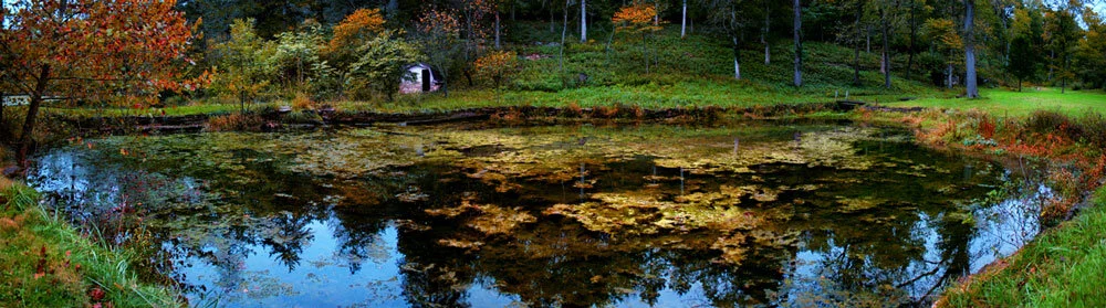
#102 – Indian Spring #102 – Indian Spring Indian spring is on private property on the south side of Springfield Missouri. The owner has meticulously maintained this property and created a beautiful area surrounding the spring. The spring is a natural spring that flows into a winding stream that spills into this small pond. The lush vegetation and clear blue water make for a beautiful photograph. I was fortunate enough to be allowed to photograph this area and I am excited to bring you more soon.
#104 – Indian Spring #104 – Indian Spring Indian spring is on private property on the south side of Springfield Missouri. The owner has meticulously maintained this property and created a beautiful area surrounding the spring. This is a natural spring that flows into a winding stream that spills into this small pond. The lush vegetation and clear blue water make for a beautiful photograph. I was fortunate enough to be allowed to photograph this area.
#105 - Lincoln Memorial#105 - Lincoln Memorial
#108 - Nathanael Green #108 - Nathanael Green This is the fall at Lake Drummond at Nathanael Greene/Close Memorial Park, located along the South Creek Greenway trail, just across the road from Horton Smith Public Golf Course. The lake was named for Anne Case Drummond, a civic force who inspired and mentored generations of Ozarks women. Her likeness is memorialized in bronze sitting on a park bench lakeside near the garden’s southern entrance. In 2014, the City’s Public Works Department completed a major stabilization and beautification project at Lake Drummond. It looks better than ever now, with the path around it passing through drifts of spring bulbs, the Woodland Garden, the English Garden and access to the South Creek Greenway.
#109 - Nathanael Green #109 - Nathanael Green Another from this113-acre Park in Springfield Missouri. One of my favorite parks with so many diver’s areas including Springfield Botanical Gardens, Dr. Bill K. Roston Native Butterfly House, Gray-Campbell Farmstead (oldest cabin in Springfield) Mizumoto Japanese Stroll Garden, Lake Drummond. The park connects to South Creek Greenway and includes several other paved walking trails. Located across the road from Horton Smith Golf Course.
#115-Route 66 Fest 02 #115-Route 66 Fest 02 One more of the Birthplace of Route 66 Festival. This photo was taken on Park Central East. Springfield is officially recognized as the birthplace of what became known as the iconic "Mother Road."
#117- Flat Creek #117- Flat Creek Near Cape Fair Missouri you will find Flat Creek, meandering through the hills and eventually flowing into Table Rock Lake. The gentle flow of this creek is calming just like the nature around it.
#127-Lurvey Corts#127-Lurvey Corts
#128 – Bois D’Arc Barn #128 – Bois D’Arc Barn Light painting and stars captured behind an old barn in the Bois D'Arc conservation area. Bois D'Arc (pronounced "Bo-dark") Conservation Area is located in Greene County Missouri, one mile north of the town of Bois D'Arc. The Osage Indians used the limbs of these trees in this area to make their bows. Thus the name Bois D'Arc, meaning "arc of wood." The Bois D'Arc area is managed primarily for bobwhite quail, doves, and cottontail rabbits. Several small, ponds serve as breeding areas for aquatic turtles and salamanders. Some lowland sites are attractive to woodcock and wetland wildlife species. A small deer herd and a few wild turkeys can be found on the area. The Andy Dalton Shooting Range and Outdoor Education Center is located on this conservation area.
#016-Springfield Art Museum#016-Springfield Art Museum
info
/
1
2
3
4
5
6
7
8
9
10
11
12
13
14
15
16
17
18
19
20
21
22
23
24
25
26
27
28
29
30
31
32
33
34
35
36
37
38
39
40
41
42
43
44
45
46
47
48
49
50
51
52
53
54
55
56
57
58
59
60
61
62
63
64
65
66
67
68
69
70
71
72
73
74
75
76
77
78
79
80
81
82
83
84
85
86
87
88
89
90
91
92
93
94
95
96
97
98
99
100
101
102
103
104
105
106
107
108
109
110
111
112
113
114
115
116
117
118
119
120
121
122
123
124
125
126
127
128
129
130
131
132
133
134
135
136
137
138
139
140
141
142
143
144
145
146
147
148
149
150
151
152
153
154
155
156
157
158
159
160
161
162
·
·
·
·
·
·
·
·
·
·
·
·
·
·
·
·
·
·
·
·
·
·
·
·
·
·
·
·
·
·
·
·
·
·
·
·
·
·
·
·
·
·
·
·
·
·
·
·
·
·
·
·
·
·
·
·
·
·
·
·
·
·
·
·
·
·
·
·
·
·
·
·
·
·
·
·
·
·
·
·
·
·
·
·
·
·
·
·
·
·
·
·
·
·
·
·
·
·
·
·
·
·
·
·
·
·
·
·
·
·
·
·
·
·
·
·
·
·
·
·
·
·
·
·
·
·
·
·
·
·
·
·
·
·
·
·
·
·
·
·
·
·
·
·
·
·
·
·
·
·
·
·
·
·
·
·
·
·
·
·
·
·